


Multispectral Sensors in Combination with Recording Tools for Cultural Heritage Documentation.
Lerma, J. L., Akasheh, T., Haddad, N., Cabrelles, M., 2011. Multispectral Sensors in Combination with Recording Tools for Cultural Heritage Documentation. Change Over Time, 1(2): 236-250.
Documentation of weathered architectural heritage with visible, near infrared, thermal and laser scanning data.
Lerma, J. L., Cabrelles, M., Akasheh, T., Haddad, N., 2012. Documentation of weathered architectural heritage with visible, near infrared, thermal and laser scanning data. International Journal of Heritage in the Digital Era, 1(2): 251-275.
Geographic Information Systems: concepts, advantages and possibilities in the field of restoration.
Seguí, A. E., Portalés, C., Cabrelles, M., Lerma, J. L., 2012. Geographic Information Systems: concepts, advantages and possibilities in the field of restoration. LOGGIA: Arquitectura y Restauración, 24-25: 208-212.
Photo-realistic 3D modelling of sculptures on open-air museums.
Duca, F., Cabrelles, M., Navarro, S., Seguí, A. E., Lerma, J. L., 2011. Photo-realistic 3D modelling of sculptures on open-air museums. Geoinformatics FCE CTU, 6: 89-96.
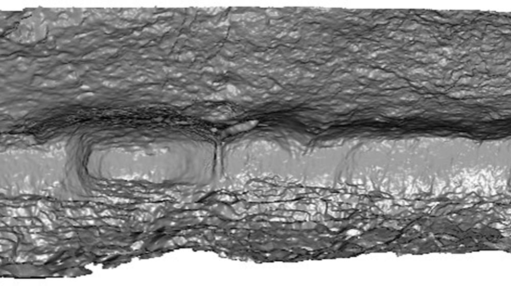
Documentación 3D de abrigos rupestres a partir de láser escáner y de procesos fotogramétricos automatizados.
Cabrelles López, M., Lerma García, J. L., 2013. Documentación 3D de abrigos rupestres a partir de láser escáner y de procesos fotogramétricos automatizados. Virtual Archaeology Review, 4(8): 64-68.
From Digital Photography to Photogrammetry for Cultural Heritage Documentation and Dissemination.
Lerma, J. L., Cabrelles, M., Navarro, S., Fabado, S., 2013. From Digital Photography to Photogrammetry for Cultural Heritage Documentation and Dissemination. DISEGNARECON, 6(12): 1-8.
Grey Level and Noise Evaluation of a Foveon X3 Image Sensor: A Statistical and Experimental Approach.
Riutort-Mayol, G., Marqués-Mateu, Á., Elena Seguí, A., Lerma, J. L., 2012. Grey Level and Noise Evaluation of a Foveon X3 Image Sensor: A Statistical and Experimental Approach. Sensors, 12(8): 10339-10368.
Statistical grey level and noise evaluation of Foveon X3 and CFA image sensors.
Marqués-Mateu, A., Lerma, J. L., Riutort-Mayol, G., 2013. Statistical grey level and noise evaluation of Foveon X3 and CFA image sensors. Optics & Laser Technology, 48: 1-15.
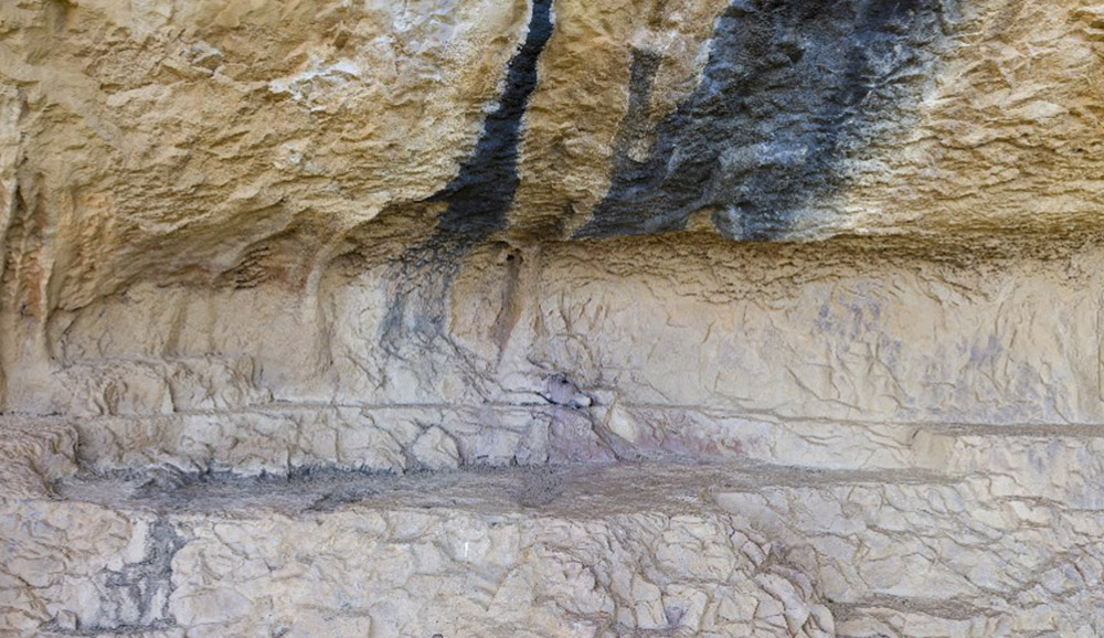
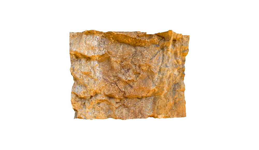
Automatic orientation and 3D modelling from markerless rock art imagery.
Lerma, J. L., Navarro, S., Cabrelles, M., Seguí, A. E., Hernández, D., 2013. Automatic orientation and 3D modelling from markerless rock art imagery. ISPRS Journal of Photogrammetry and Remote Sensing, 76: 64-75.
A robust and hierarchical approach for the automatic co-registration of intensity and visible images.
González-Aguilera, D., Rodríguez-Gonzálvez, J., Hernández-López, D., Lerma, J.L., 2012. A robust and hierarchical approach for the automatic co-registration of intensity and visible images. Optics & Laser Technology, 44(6): 1915-1923.
Geometric calibration of a terrestrial laser scanner with local additional parameters: An automatic strategy.
García-San-Miguel, D., Lerma, J. L., 2013. Geometric calibration of a terrestrial laser scanner with local additional parameters: An automatic strategy. ISPRS Journal of Photogrammetry and Remote Sensing, 79: 122-136.
Calibración geométrica de escáner láser terrestre mediante software específico.
García San Miguel, D., Lerma García, J. L., Navarro Tarín, S., 2013. Calibración geométrica de escáner láser terrestre mediante software específico. Mapping, 22(158): 30-39, 2013.
Calibration and direct georeferencing analysis of a multi-sensor system for cultural heritage recording.
Hernández-López, D., Cabrelles, M., Felipe-García, B., Lerma, J. L., 2012. Calibration and direct georeferencing analysis of a multi-sensor system for cultural heritage recording. Photogrammetrie, Fernerkundung, Geoinformation, (3): 237-250.
Self-calibration of terrestrial laser scanners: selection of the best geometric additional parameters.
Lerma, J. L.; García-San-Miguel, D., 2014. Self-calibration of terrestrial laser scanners: selection of the best geometric additional parameters. ISPRS Annals of the Photogrammetry, Remote Sensing and Spatial Information Sciences, Volume II-5: 219-226.
. Virtual Worlds for Photogrammetric Image-Based Simulation and Learning.
Piatti, E.J., Lerma, J. L., 2013. Virtual Worlds for Photogrammetric Image-Based Simulation and Learning. The Photogrammetric Record, 28(141): 27-42.
Geographic Information Systems: concepts, advantages and possibilities in the field of restoration.
Seguí, A. E., Portalés, C., Cabrelles, M., Lerma, J. L., 2012. Geographic Information Systems: concepts, advantages and possibilities in the field of restoration. LOGGIA: Arquitectura y Restauración, 24-25: 208-212.