Español | English

3DVEM — Register

3DVEM — Register is a low cost software that solves the registration, also known as alignment or relative orientation, of point clouds, point clouds and 3D models, as well as 3D models, all of them scaled, from a sufficient number of matching (homologous) features identified in a variety of ASCII formats.

Matching features may be centres of targets and spheres, among others, as well as natural points or points extracted from digital models. Numbering/naming of features is initially random, since the software sets automatically features, and solves the indirect registration by means of either least squares or robust estimation, depending on the option selected by the user.

3DVEM — Register advantages:

  • Easiness to solve registration: point cloud to point cloud, point cloud to surface or surface to surface.
  • Least squares adjustment or robust estimation solution (Danish method and Minimum Sum) to detect gross errors (outliers).
  • Full list of errors and precision estimates of the parameters.
  • Import and export point clouds and 3D models in multiple formats (ASC, TXT, PTS, PTX, LAS, FLS, FWS, OBJ, WRL, DXF, etc.).
  • Improvement of the results up to 10 times, using the same observables.
  • Versatility of use of LiDAR data: close range, terrestrial, aerial, etc.

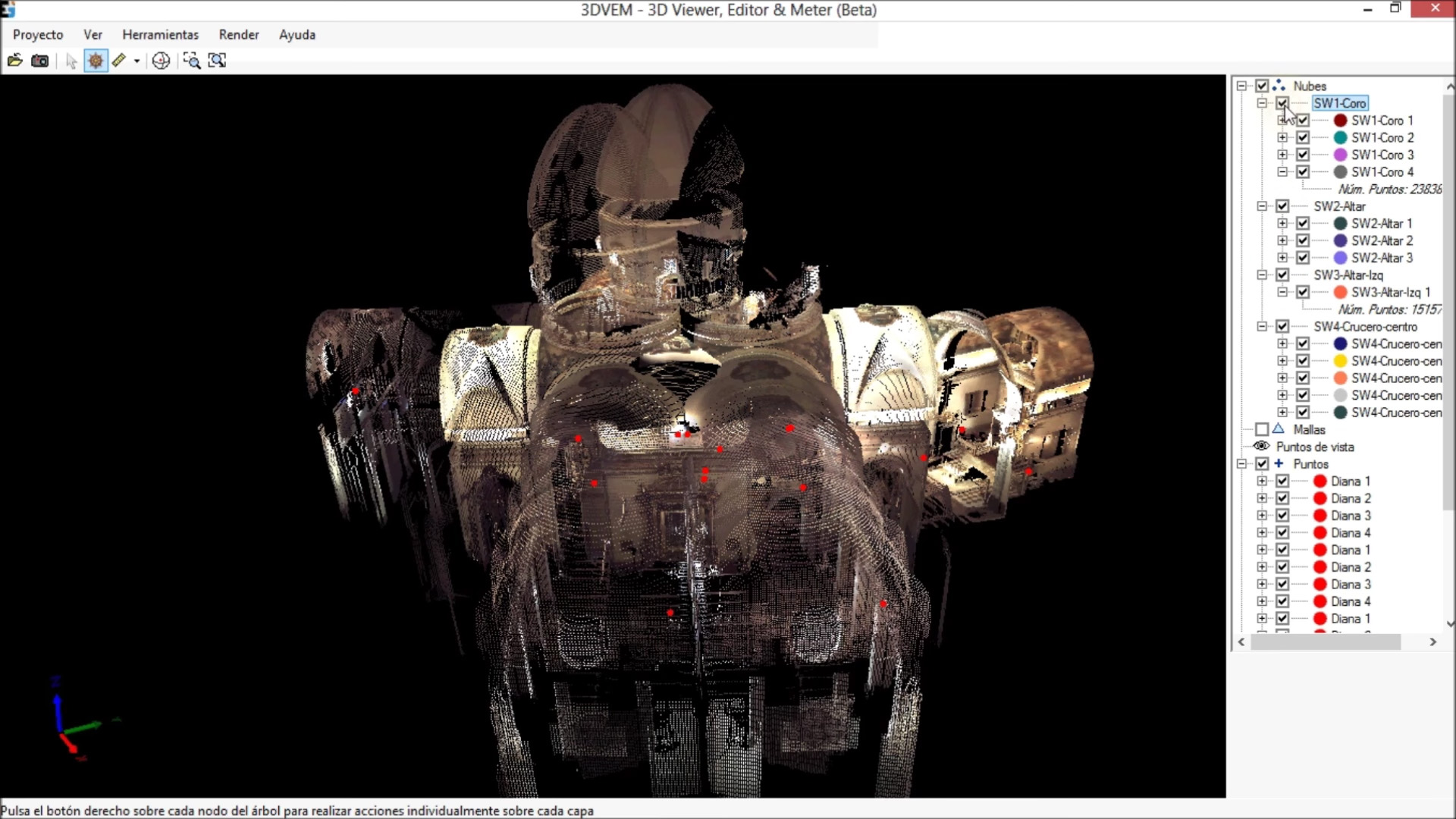
  • Point clouds inside a church unaligned.

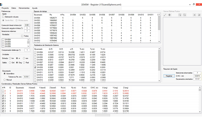
    Point clouds after registration in 3DVEM — Register.

    Point clouds registration in 3DVEM — Register.

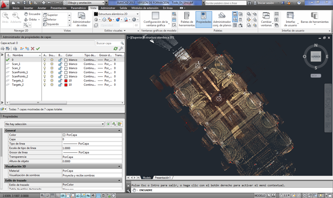
    DXF file import. The CAD file is structured in layers: point clouds, stations and targets.

    Contact us to download the software. If you want, you can check some of the available tutorials:

  • DEMO 1:This tutorial imports .PTS files (from Leica Geosystems) with unnumbered targets, and performs the whole registration, explaining the different steps, included the generation of reports, error analysis, generation of 3D visualisations in 3D in VRML and DXF, as well as the export of the data.
  • DEMO 2: Easy and fast registration with 17 FARO Focus3D scans and spheres.
  • DEMO 3: How targets/spheres/3D points coordinates can be merge to LiDAR datasets (point clouds or 3D models) where there was no point available for registration.
  • Tutorial. How to use 3DVEM – Register in only 5 steps.